Minecraft:Sri Syadasti Waterway
The Sry Syradasti Waterway is a large artificial waterway near the eastern entrance of the Malaclypse Interior Waterway at Green Willie Naval Station that connects the East Sea to the North Sea.
Ports

Currently there is one port, but a port at Ravenhurst is planned.
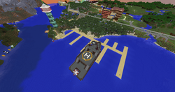
There are at present no ports on the canal open to the public, but there are ports at Ocean View west of the northern terminus for medium sized craft. Permission may be granted to dock at Green Willie Naval Station.
Bridges
All bridges offer a clearance of at least 100 metres from the surface of the water. The following bridges span the canal:
- Probeland rail and pedestrian bridge (from Eristotle to Probeland)
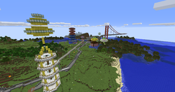
- Emperor Norton I Memorial Skyway (an enormous bridge containing shops and houses)
Tunnels
At present there is only one tunnel, presently under construction:
- Hodge-Podge tunnel
Markers
The canal uses various buoys at several places to signal to mariners various conditions, hazards, or boundaries.
Red
Red buoys mark forbidden or extremely dangerous areas. Crossing red areas may result in boats (even small craft) being destroyed, whether by natural or artificial forces.
Orange
Orange buoys mark extremely hazardous obstacles or conditions, such as bridge piers. All craft should avoid these areas and exercise great care near them.
Yellow
Yellow buoys mark areas which may be safe for very small ships, but larger ships should avoid. This includes smaller waterways and shoals.
Lighthouses


Lighthouses on the canal include:
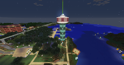
- Prickle-Prickle Tower, near the entrance
- Green Willie Light, near Green Willie Naval Station
- Terminus Light, near the canal exit
Naval Stations
Template:Hatnote The canal passes entirely through Erisiana territory and is thus its sovereign territory. There is at present one naval station:
- Green Willie Naval Station